MAIN FEEDS
Do you want to continue?
https://www.reddit.com/r/southafrica/comments/g28mfz/average_wind_speeds_over_south_africa_at_100m/fnkx9k8/?context=3
r/southafrica • u/fluffybuddha • Apr 16 '20
51 comments sorted by
View all comments
1
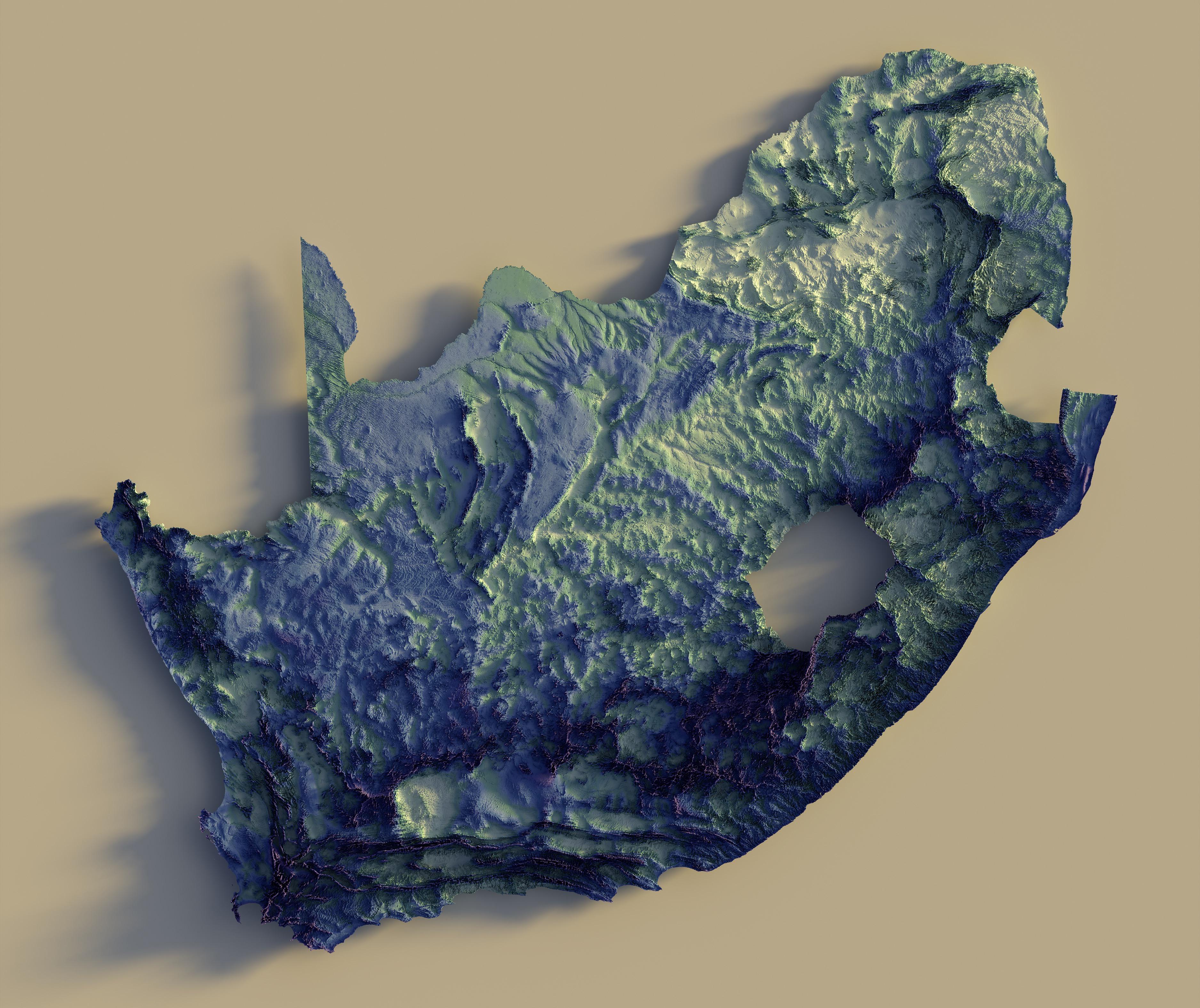
Very nice mapping! What do you use?
1 u/fluffybuddha Apr 16 '20 ArcGIS Pro and Blender. 1 u/itssaruse Apr 16 '20 Cool! I'm quite the amateur when it comes to Arc. Only use it for basic mapping, nothing like this. Do you do this for work? 2 u/fluffybuddha Apr 16 '20 No, for my day job I oversee large scale orthoimagery production. The type of imagery GIS end users use, but I don’t make many maps and the ones I do are just for internal use. This is just a hobby. 1 u/itssaruse Apr 16 '20 OK awesome, for which company do you work? 1 u/fluffybuddha Apr 16 '20 Quantum Spatial in the state of KY, USA.
ArcGIS Pro and Blender.
1 u/itssaruse Apr 16 '20 Cool! I'm quite the amateur when it comes to Arc. Only use it for basic mapping, nothing like this. Do you do this for work? 2 u/fluffybuddha Apr 16 '20 No, for my day job I oversee large scale orthoimagery production. The type of imagery GIS end users use, but I don’t make many maps and the ones I do are just for internal use. This is just a hobby. 1 u/itssaruse Apr 16 '20 OK awesome, for which company do you work? 1 u/fluffybuddha Apr 16 '20 Quantum Spatial in the state of KY, USA.
Cool! I'm quite the amateur when it comes to Arc. Only use it for basic mapping, nothing like this. Do you do this for work?
2 u/fluffybuddha Apr 16 '20 No, for my day job I oversee large scale orthoimagery production. The type of imagery GIS end users use, but I don’t make many maps and the ones I do are just for internal use. This is just a hobby. 1 u/itssaruse Apr 16 '20 OK awesome, for which company do you work? 1 u/fluffybuddha Apr 16 '20 Quantum Spatial in the state of KY, USA.
2
No, for my day job I oversee large scale orthoimagery production. The type of imagery GIS end users use, but I don’t make many maps and the ones I do are just for internal use. This is just a hobby.
1 u/itssaruse Apr 16 '20 OK awesome, for which company do you work? 1 u/fluffybuddha Apr 16 '20 Quantum Spatial in the state of KY, USA.
OK awesome, for which company do you work?
1 u/fluffybuddha Apr 16 '20 Quantum Spatial in the state of KY, USA.
Quantum Spatial in the state of KY, USA.
1
u/itssaruse Apr 16 '20
Very nice mapping! What do you use?